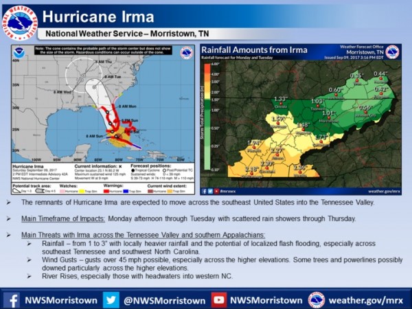
The forecast for Hurricane Irma and its expected impacts across East Tennessee, southwest Virginia, and southwest North Carolina as of Saturday afternoon, Sept. 9, 2017. (Image courtesy National Weather Service in Morristown)
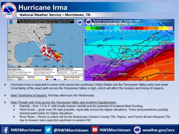
The National Weather Service in Morristown on Saturday afternoon released updated information on the expected impacts of Hurricane Irma in East Tennessee, southwest Virginia, and southwest North Carolina.
The strong winds and outer rain bands of the hurricane, which has weakened to a Category 3 storm from an earlier Category 5, started hitting the Florida Keys on Saturday as officials warned of a potentially deadly storm surge in southern Florida.
The storm track appeared to have moved farther west than originally forecast, and Hurricane Irma was expected to now have a bigger impact on central and western Florida as it moved up the peninsula.
The remnants of the storm, which had sustained winds of 125 mph on Saturday afternoon, are expected to move across the southeast United States and into the Tennessee Valley, possibly starting Monday afternoon and continuing through Tuesday, with scattered showers through Thursday. [Read more…]