• About
    • About Us
    • What We Cover
  • Advertise
    • Advertise
    • Our Advertisers
  • Contact
  • Donate
  • Send News

Oak Ridge Today

  • Home
  • Sign in
  • News
    • Business
    • Community
    • Education
    • Government
    • Health
    • Police and Fire
    • U.S. Department of Energy
    • Weather
  • Sports
    • High School
    • Middle School
    • Recreation
    • Rowing
    • Youth
  • Entertainment
    • Arts
    • Dancing
    • Movies
    • Music
    • Television
    • Theater
  • Premium Content
  • Obituaries
  • Classifieds

President declares disaster for Tennessee, including Anderson, Roane

Posted at 12:37 am August 14, 2014
By John Huotari Leave a Comment

Passtime Garage Storm Damage

Passtime Garage on South Main Street in Clinton was damaged by a fast-moving storm and severe winds in early June. (Photo courtesy WYSH Radio/WGAP Radio)

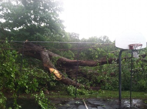
WASHINGTON—The U.S. Department of Homeland Security’s Federal Emergency Management Agency announced Wednesday that federal disaster aid has been made available to the state of Tennessee to supplement state and local recovery efforts in the area affected by severe storms, tornadoes, straight-line winds and flooding from June 5-10.

The action by President Barack Obama makes federal funding available to state and eligible local governments and certain private nonprofit organizations on a cost-sharing basis for emergency work and the repair or replacement of facilities damaged by severe storms, tornadoes, straight-line winds, and flooding in Anderson, Bledsoe, Carroll, Decatur, Henry, Hickman, Houston, Lawrence, Lewis, Madison, Marion, Maury, McNairy, Moore, Perry, Roane, Sequatchie, and Tipton counties, officials said.

Federal funding is also available on a cost-sharing basis for hazard mitigation measures statewide, FEMA said in a press release.

W. Michael Moore has been named as the federal coordinating officer for federal recovery operations in the affected area. Moore said additional designations may be made at a later date if requested by the state and warranted by the results of further damage assessments. [Read more…]

Filed Under: Anderson County, Federal, Government, Roane County, State, Top Stories, Weather Tagged With: Anderson, Barack Obama, Clinton, disaster aid, East Tennessee, federal disaster aid, Federal Emergency Management Agency, FEMA, flooding, Kingston, Oak Ridge, Roane, severe storm, straight-line winds, tornado, tornadoes, U.S. Department of Homeland Security, W. Michael Moore

About 1,600 lost power in Sunday storms

Posted at 6:31 pm July 28, 2014
By John Huotari Leave a Comment

About 1,600 customers lost power during the two major bands of storms that ripped through Oak Ridge at around 8 p.m. and midnight Sunday night, Oak Ridge Electric Director Jack Suggs said.

The outages were concentrated around 15 distinct locations, and the east end of town was hit the hardest, Suggs said. The Oak Ridge Electric Department started working on repairs as soon as it could bring in people to help, and crews have been working continuously to restore power.

Suggs said most everyone had power restored by noon Monday. Others had had power restored earlier, some at midnight, more at 3 a.m., then still more by 4 a.m. The majority were back on by 7 a.m. Monday, and crews started “whittling away” at those who were left. [Read more…]

Filed Under: Government, Oak Ridge, Top Stories, Weather Tagged With: Briarcliff, Connors Circle, damage, EF-3 tornado, Jack Suggs, Oak Ridge Electric Department, outages, power, Speedwell, storms

Tornado watch, severe storms possible Sunday evening

Posted at 6:20 pm July 27, 2014
By Oak Ridge Today Staff Leave a Comment

National Weather Service Severe Weather Threat

Image courtesy of National Weather Service in Morristown.

Note: This story was updated at 6:55 p.m. with a new tornado warning.

A tornado watch is in effect for the northern half of East Tennessee—including Anderson, Knox, and Roane counties—through 8 p.m., and there is a chance of severe thunderstorms near Oak Ridge through midnight, the National Weather Service said.

Update: A tornado warning was issued at 6:26 p.m. for southern Campbell County, Scott County, and northwestern Anderson County. It’s in effect through 7:15 p.m., and it applies to Lake City and Rosedale in Anderson County, as well as LaFollette, Caryville, and Jacksboro in Campbell County, and Huntsville and Oneida in Scott County. (The tornado warning has since been extended to 7:45 p.m.)

Radar showed a severe thunderstorm capable of producing a tornado. The dangerous storm was located over Helenwood, about eight miles south of Oneida, and moving southeast at 35 mph, the NWS said.

People in the affected areas should take cover now, moving to a basement or interior room on the lowest floor of sturdy building. Windows should be avoided. If in a mobile home or outdoors, move to the closest substantial shelter and protect yourself from flying debris. [Read more…]

Filed Under: News, Top Stories, Weather Tagged With: damaging winds, East Tennessee, flooding, heavy rain, large hail, National Weather Service, NWS, Oak Ridge, severe thunderstorms, severe weather, showers, thunderstorms, tornado watch, tornadoes

Guest column: Anderson communications center very busy during Tuesday storm

Posted at 11:31 am June 15, 2014
By Oak Ridge Today Staff Leave a Comment

Anderson County Commission and Mark Lucas

Anderson County Sheriff’s Department Chief Deputy Mark Lucas is pictured above at right during a special County Commission meeting in November. Also pictured are Anderson County Commissioners Rick Meredith, center, and Jerry White.

To All:

(Tuesday) evening was very, very busy. From 3 p.m. until 11 p.m., our communications center received 589 telephone calls, of which 143 were on 911. The overwhelming number of calls were between 5 p.m. and 7 p.m., when 365 calls came to our dispatch center. Of these 365 calls, 109 were on 911.

Comparing to last Tuesday from 3 p.m. until 11 p.m., we received 156 total telephone calls, of which 20 were on 911. The two-hour period from 5 p.m. to 7 p.m. last week was only 41 total calls, of which five were on 911.

For the entire shift from 3 p.m. until 11 p.m., that was a 288 percent increase. For the two hours from 5 p.m. until 7 p.m., the increase was 790 percent.

We had four communications officers working (Tuesday) when the storm hit. A fifth came into work on her own to help out. Many of these 911 and non-emergency calls required dispatching of emergency personnel from law enforcement, fire, or EMS. Others required notifications to the state and county highway departments and the utility companies. It was non-stop for hours. [Read more…]

Filed Under: Anderson County, Guest Columns, Opinion, Police and Fire, Weather Tagged With: 911, Anderson County, Anderson County EMS, Anderson County Highway Department, Anderson County Sheriff's Department, Clinton, Clinton Utilities Board, communications center, dispatch, emergency personnel, EMS, fire, Lake City, law enforcement, Mark Lucas, non-emergency calls, Norris, Oak Ridge, Oliver Springs, rescue squad, Sheriff's Communications Center, storm, telephone calls, Tennessee Department of Transportation, Tuesday storm, volunteer fire departments

WYSH: Storm damage follow-up; EF0 tornado confirmed in Kingston

Posted at 1:32 pm June 12, 2014
By Oak Ridge Today Staff Leave a Comment

Mike Marsh Home Storm Damage

One of several pictures showing the storm damage Tuesday to the home of Mike and Wanda Marsh on Timbercrest Drive in Oak Ridge. (Photo courtesy Mike Marsh)


Information from WYSH Radio

The National Weather Service has confirmed the powerful storms that rolled through the area on Tuesday included an embedded tornado in Kingston.

Officials with the NWS office in Morristown assessed the damage and said an EF-0 tornado touched down along 3rd Street in Kingston. The winds of an EF-0 tornado are around 65-85 miles per hour.

The NWS said the widespread damage throughout East Tennessee was almost entirely from straight-line winds and down-bursts. Kingston is the only site suspected of sustaining tornado damage.

The Weather Service says straight-line winds estimated at 80 mph packed a destructive punch in Clinton, which appeared to bear the brunt of the damage from Tuesday’s severe weather. [Read more…]

Filed Under: Top Stories, Weather Tagged With: Clinton, Clinton High School, Clinton Utilities Board, damage, down-bursts, EF-0, electricity, Hoskins Drug Store, Jack Suggs, Kingston, National Weather Service, Norris, Norris Road, NWS, outages, Pass Time Garage, power, storms, straight-line winds, tornado, tornado damage

Oak Ridge: 4,000 lose power, 70 homes damaged

Posted at 1:05 pm June 11, 2014
By John Huotari 1 Comment

Wadsworth Circle Home Tree

One of two trees that fell on a home on West Wadsworth Circle. The second tree, visible on the ground in the background, punched a hole in the roof and displaced a mother, grandmother, and two children.


Note: This story was last updated at 2:40 p.m.

Roughly 4,000 customers lost power in the Tuesday evening storm, and about 70 damaged homes will require repairs by an electrician before power can be restored, an Oak Ridge official said Wednesday morning.

Oak Ridge Electric Director Jack Suggs said he doesn’t recall ever having 70 homes damaged in one storm, although the Electric Department has experienced worse storms when many utility poles were broken. But the brief, fierce Tuesday storm, which brought severe winds and driving rain, was significant in terms of its damage to homes and its far-reaching nature, from Blair Road on the west end of town to east Oak Ridge and beyond—into Clinton and Anderson County, Suggs said.

“It was pretty widespread,” Suggs said.

Janet Bowker on Plymouth Circle and Storm Debris

Janet Bowker, left, walks through debris on Plymouth Circle in front of her home, where a tree fell into her bedroom during the Tuesday evening storm. Her home is at right but not visible in this picture. There were no injuries, but Bowker does not have power now.


The storm, which ripped through Oak Ridge at about 5:30 p.m. Tuesday, left a trail of debris: scattered branches and limbs, broken trees, fallen power lines, and damaged buildings and homes. It also triggered a flood of calls to the city’s 911 call dispatch center.

About 500 customers remained without power around noon Wednesday, including the 70 damaged homes. [Read more…]

Filed Under: Government, Oak Ridge, Slider, Top Stories, Weather, Weather Tagged With: Anderson County, BBB-TV, Clinton, Clinton Utilities Board, CUB, damaged homes, Dustin Byrd, electricity, Highland View, Hunter Circle, Jack Suggs, Janet Bowker, Kingston, Lake City Highway, National Weather Service, NWS, Oak Ridge Electric Department, Passtime Garage, Plymouth Circle, power, power lines, rain, repairs, Roane County, severe winds, storm, Wadsworth Circle, WYSH Radio

Another 12 hours or so to restore power, Electric Department says

Posted at 11:07 pm June 10, 2014
By John Huotari Leave a Comment

Willow Run Fallen Tree

A giant tree fell at Willow Run Apartments in Clinton and wrecked the fence at the basketball and tennis courts. (Photo courtesy Jim Harris)


It could take another 12-13 hours to restore power across Oak Ridge after the severe Tuesday evening storms, the Oak Ridge Electric Department said on Twitter at roughly 9:30 p.m. Tuesday.

That would presumably mean that some customers might not have electricity restored until sometime Wednesday morning.

The Electric Department said the storms knocked down many trees and limbs. Crews have responded to fallen trees, power outages, dangling utility lines, and other problems across town since the short, fierce storm ripped through Oak Ridge and Anderson County at about 5:30 p.m. Tuesday. The Electric Department warned residents to stay away from power lines on the ground.

At about 10 p.m. Tuesday, Oak Ridge workers were out cutting up trees and restoring power on Jefferson Avenue.  A few miles away off Pennsylvania Avenue, Plymouth Circle was blocked to traffic, and it appeared that there was a utility line on the road blocked by orange traffic cones. [Read more…]

Filed Under: Government, Oak Ridge, Top Stories, Weather Tagged With: electricity, Jefferson Avenue, Oak Ridge Electric Department, Outer Drive, Pennsylvania Avenue, Plymouth Circle, storms

Photo: Double rainbow in Oak Ridge

Posted at 9:21 pm May 23, 2014
By Oak Ridge Today Staff Leave a Comment

Double Rainbow

Double rainbow (Photo by the Rev. Sharon Youngs)


Submitted

Hail, Double Rainbow!

“Notice that the colors in the rare secondary rainbow are reversed from those of the primary rainbow,” said Herb Krause, retired Oak Ridge National Laboratory physicist. “The primary rainbow is caused by a single reflection of sunlight in each raindrop, and the secondary rainbow is caused by a double reflection.”

Filed Under: Front Page News, Media, Photos, Weather Tagged With: double rainbow, Herb Krause, Oak Ridge, Oak Ridge National Laboratory, primary rainbow, secondary rainbow, Sharon Youngs

Forecast: Severe thunderstorms, heavy rain; tornado, flood watches issued

Posted at 3:29 pm April 28, 2014
By Oak Ridge Today Staff Leave a Comment

NWS Severe Thunderstorms, Rain, Wind

Image courtesy National Weather Service in Morristown.


Severe thunderstorms, heavy rain, and flooding are possible in the region starting Monday evening and continuing through Tuesday night, according to the National Weather Service in Morristown.

Isolated tornadoes are possible, mainly across the Cumberland Plateau and southern half of the Tennessee Valley, the Weather Service said. A tornado watch remains in effect until 8 p.m. Monday for southwestern Virginia and East Tennessee. The watch includes Anderson, Blount, Campbell, Knox, Loudon, Morgan, Roane, and Scott counties, among others.

The flood watch is in effect from 8 p.m. today until 8 a.m. Tuesday.

The National Weather Service said its main concerns are the isolated tornadoes, widespread damaging winds that could cause power outages due to fallen trees and power lines, and heavy rainfall producing flash flooding. Large hail is also possible.

The forecast near Oak Ridge calls for a 60 percent chance of heavy rain this afternoon, with a 100 percent chance of severe thunderstorms tonight. [Read more…]

Filed Under: Top Stories, Weather Tagged With: Cumberland Plateau, flash flooding, flood watch, flooding, hail, heavy rain, low-pressure system, National Weather Service, NWS, Oak Ridge, severe thunderstorms, Tennessee Valley, thunderstorms, tornado watch, tornadoes, wind gusts, winds

Weather: Schools, courts, offices closed; Wildcats sectional game now on Tuesday

Posted at 10:42 am March 3, 2014
By John Huotari Leave a Comment

Note: This story was last updated at 1:20 p.m.

Schools in Anderson County, Clinton, and Knox and Morgan counties are closed today (Monday) because of weather conditions and possible icing. And the Wildcats boys’ basketball sectional game in Kingsport, featuring Oak Ridge and Dobyns-Bennett, has been postponed to 7 p.m. Tuesday.

Roane State Community College is closing its Campbell, Cumberland, Morgan, Scott, and Fentress county campuses due to icy roads. The campuses in Oak Ridge and Loudon, Knox, and Roane counties are open, but classes at the Clinton facility have been canceled.

The afternoon docket for the Anderson County General Sessions Court in Clinton has been canceled starting at 1 p.m. The afternoon docket for Anderson County Juvenile Court has also been canceled. And the Anderson County Courthouse closed at 1 p.m.

Tennessee officials said state offices will be closed the remainder of the day statewide, but mission-critical state employees will report to work as usual. [Read more…]

Filed Under: College, Education, High School, K-12, Sports, Top Stories, Weather Tagged With: Anderson County, Anderson County Schools, basketball, Clinton, Dobyns-Bennett, ice, icing, Kingsport, Morgan County, National Weather Service, Oak Ridge, Roane State Community College, snow, Wildcats

Environmentalists, others to challenge Fleischmann, Duncan on global warming

Posted at 10:18 am February 20, 2014
By Oak Ridge Today Staff 1 Comment

Volunteers have organized two press conferences today (Thursday) to challenge Tennessee congressmen John Duncan and Chuck Fleischmann to accept and then work to stop human-caused climate change, a press release said.

The first press conference is at 11 a.m. Thursday at Duncan’s Knoxville office at the Howard H. Baker Jr. U.S. Courthouse. The second is at 2 p.m. in front of the Bull Run Fossil Plant in Claxton.

The press release said the press conferences will include prominent business people, clergy, a fossil fuel technologist, a child advocate, environmentalists, educators, and students. [Read more…]

Filed Under: Clinton, Government, Top Stories, Uncategorized, Weather Tagged With: Bull Run Fossil Plant, carbon dioxide, Chuck Fleischmann, climate change, CO2, global warming, green energy, John Duncan, Todd Waterman

Former energy secretary compares global warming path to Russian roulette, with gun pointed at knee

Posted at 8:04 pm February 17, 2014
By John Huotari Leave a Comment

Steven Chu on Global Warming at Oak Ridge National Laboratory

During a lecture at Oak Ridge National Laboratory, former Energy Secretary Steven Chu compares global warming to Russian roulette, but with the gun pointed at a kneecap.

Former Energy Secretary Steven Chu sounded an alarm about global warming during a visit to Oak Ridge last week, comparing the current path to Russian roulette, but with the gun pointed at a knee—and with more bullets added each decade.

“Every decade you put in a bullet and you pull the trigger,” said Chu, a Stanford University professor who won a Nobel Prize in physics in 1997. “After four or five more decades, it could be fully loaded.”

The longest-serving secretary of the U.S. Department of Energy, Chu gave a lecture at Oak Ridge National Laboratory on Wednesday.

The globe is warming, and we might not feel the full effect of the greenhouse gases emitted by humans for another half-century or more, after the ocean has been warmed, Chu said.

“We’re going to glide to a temperature that we’re not really sure about, but I can guarantee that it’s warmer than it is today because of that ocean,” Chu said. “The damage that we’ve done today will not be seen for at least 50 years.” [Read more…]

Filed Under: Oak Ridge National Laboratory, Science, Slider, Top Stories, Weather, Weather Tagged With: Alaska, batteries, carbon capture, carbon sequestration, carbon tax, emissions, Energy Secretary, energy use, global warming, greenhouse gases, Greenland, ice masses, Nobel Prize, Oak Ridge National Laboratory, physics, Russian roulette, Stanford University, Steven Chu, temperature increase, U.S. Department of Energy

« Previous Page
Next Page »

Search Oak Ridge Today

Recent Posts

  • ORAU and American Museum of Science and Energy Foundation formalize partnership to advance Manhattan Project 2.0
  • Author and Law Professor Derek W. Black to Speak on Public Education and Democracy
  • Anderson County Chamber Headquarters Dedication Set for October 17
  • ORISE announces winners of 2025 Future of Science Awards
  • SL Tennessee Supports New Anderson County Chamber Headquarters
  • ORAU 2025 Pollard Scholarship recipients announced
  • Democratic Womens Club Hosts State Rep. Sam McKenzie
  • Flatwater Tales Storytelling Festival Announces 2025 Storytellers
  • Laser-Engraved Bricks Will Line Walkway of New Chamber Headquarters
  • Democratic Womens Club to Discuss Climate Change, Energy and Policy

Copyright © 2025 Oak Ridge Today