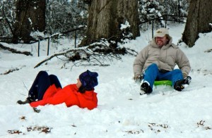
Kids build a snowman at Blankenship Field on Thursday morning after more than eight inches of snow fell in Oak Ridge. From left are Killian Fillmore, Andrew Bivens, Gavin Hensley, and Liam Hensley.
Note: This story was last updated at 5:02 p.m. with more photos.
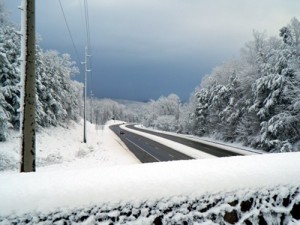
More than eight inches of snow fell in parts of Oak Ridge between Wednesday night and Thursday morning as a major winter storm hit the Southeast, and there were reports of as much as 10 to 12 inches in parts of Anderson County. A meteorologist at the National Weather Service in Morristown said it’s the most snow in East Tennessee in more than a decade.
“It’s been about 15 years since we’ve had a snow like this,” NWS Meteorologist David Hotz said. “This is definitely one of the best ones we’ve had in quite a while.”
The last snowfall of a similar magnitude that he could recall was in either 1998 or 1999.
Other big snowfalls include the historic 1993 storm and a winter storm in 1996 that dumped 15 to 17 inches.

Crews from the Oak Ridge Public Works Department worked all day Wednesday and through the night into Thursday to clear roads, including South Illinois Avenue, as more than eight inches of snow fell in parts of the city.
The wet, heavy snow that started falling in Oak Ridge at about 7 p.m. Wednesday—it was the second round of snow that day—continued into Thursday morning. But with temperatures rising Thursday morning and the sun coming out, much of the snow was quickly melting.
Still, many roads, particularly side streets, still had slush on them, and there were a few slippery spots.
Crews from the Oak Ridge Public Works Department worked all day Wednesday, through the night, and into Thursday morning. They put down two layers of brine, or highly salted water, before the snow started and switched to salt trucks and snow plows once the snow started falling.
Public Works Department Gary Cinder said there were no major problems.
“It’s been a calm event,” Cinder said. “It was a heavy snow. It was deep enough that we could push it, and it was wet enough that it would slide easily. It wasn’t sticking because of the brine.”

There are few cars on South Illinois Avenue near Centrifuge Way after a winter storm dumped eight to 12 inches of snow on parts of Oak Ridge and Anderson County.
It might have helped that many people stayed off the roads as many offices, schools, and businesses closed early on Wednesday—if they hadn’t already been closed for the day—and remained closed on Thursday.
Cinder said the Public Works Department was able to keep the main streets relatively clear. At times, though, the snow was heavy enough that it was recovering roads that crews had already plowed.
“A lot of times, they just had to go back and forth,” Cinder said.
There were three significant power outages caused by trees. The longest one, which was on Gum Hollow Road, affected about 200 people and lasted between five and six hours, said Margaret Elgin, Oak Ridge Electric Department engineering division manager. The outage was caused by pine trees that fell and broke a pole.
A second outage early Thursday morning was brief but affected about 1,000 people in the Woodland neighborhood. A big pine limb fell on power lines, but no repairs were needed, Elgin said.
The third outage, which occurred Thursday morning, affected “M” streets east of Montana Avenue and north of Oak Ridge Turnpike, as well as a few “B” streets, part of Robertsville Road, and several blocks of West Outer Drive. Fallen tree limbs broke electrical lines, knocking out power to more than 500 people. That outage lasted about two to three hours, Elgin said.
There were a few other small scattered outages throughout the night, and crews finished most storm-related repairs by lunch Thursday.
“We worked really steady all through the night,” Elgin said. “Considering that it was such a heavy snow, I think we fared fairly well.”
In Anderson County, Sheriff’s Department Chief Deputy Mark Lucas said the Tennessee Department of Transportation and the Anderson County Highway Department were working to clear the snow, but roads remained hazardous.
“Travel is not advised,” Lucas said in a Thursday morning e-mail. “We had several reports of minor accidents with cars off in the ditch or stuck in the snow, but since the snow didn’t begin to fall until the evening hours, traffic was light. There also have been a few trees down as well.”
Lucas said there were also some power outages overnight, but it appeared that the Clinton Utilities Board had most of those restored except for a few isolated areas.
He advised residents to check with CUB for details and said power outages can be viewed at http://outage.clintonub.com.
Deputies went to their “snow plan” Wednesday evening and are patrolling the county in four-wheel-drive vehicles.
“We are responding only to accidents with injury or those that are a significant traffic hazard,” Lucas said.
Cinder said Oak Ridge has eight trucks outfitted with snow plows in the front and salt spreaders in the back. The city has two bins that, when fully loaded, can store 2,400 tons of salt. Oak Ridge has plenty of salt for the rest of the winter, he said.
There about 220 miles of roads in Oak Ridge, and crews focus first on main streets and state routes such as Illinois Avenue and Oak Ridge Turnpike and then collector city streets such as Pennsylvania, Georgia, and Florida avenues. They then move on to neighborhood side streets if the snow lasts long enough and is heavy enough.
The number of lane miles that crews have to plow is double the road mileage because they have to go up streets in one lane and then back down them in another.
Hotz, the meteorologist, said water on East Tennessee roads could re-freeze tonight as the temperature drops into the 20s and that could cause problems, including black ice, especially on secondary streets that still have slush. Drivers should use caution when driving tonight, especially on secondary streets, although well-traveled roads and interstates should be in good shape, Hotz said.
He said there could be another smaller storm system late Friday and Friday night. It could start with rain that changes over to snow, and there could be some light accumulations in East Tennessee valleys, but more snow is expected in the mountains, Hotz said.
The temperature is expected to warm back up into the 50s and lower 60s next week, Hotz said.


Leave a Reply