• About
    • About Us
    • What We Cover
  • Advertise
    • Advertise
    • Our Advertisers
  • Contact
  • Donate
  • Send News
  • Subscribe

Oak Ridge Today

  • Home
  • Sign in
  • News
    • Business
    • Community
    • Education
    • Government
    • Health
    • Police and Fire
    • U.S. Department of Energy
    • Weather
  • Sports
    • High School
    • Middle School
    • Recreation
    • Rowing
    • Youth
  • Entertainment
    • Arts
    • Dancing
    • Movies
    • Music
    • Television
    • Theater
  • Premium Content
  • Obituaries
  • Classifieds


Flood watch starts this afternoon after week of winter weather

Posted at 1:09 pm February 21, 2015
By John Huotari 2 Comments

Flood Watch Feb. 21, 2015

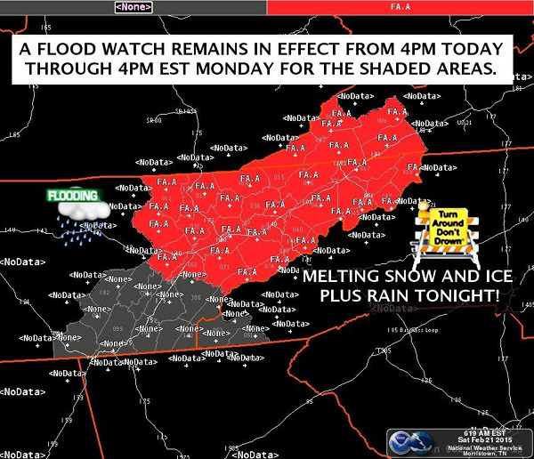
Image courtesy National Weather Service in Morristown


Note: This story was last updated at 1:31 p.m.

A flood watch will be in effect for parts of East Tennessee, including Anderson County, and parts of southwest Virginia and North Carolina starting this afternoon (Saturday, February 21) and continuing through Sunday afternoon, forecasters said.

The flood watch follows a week of winter weather that included icy precipitation on Monday, snow on Wednesday morning, bitter cold on Thursday and Friday, and more snow starting Friday night.

But the National Weather Service in Morristown said the forecast calls for melting snow and ice Saturday night in addition to rain.

Advertisement

“After lots of snow and ice this week, warming temperatures and about an inch of rain tonight may cause flooding,” the NWS said. “Be alert if you live in flood-prone areas, especially near creeks and streams in the higher elevations where heavier snow cover lingers.”

The flood watch includes Oak Ridge, Clinton, Knoxville, Lenoir City, and Kingston, and Blount, Campbell, Scott, Loudon, Morgan, Knox, and Roane counties.

In an announcement posted at 12:49 p.m. Saturday, the NWS said minor flooding is possible as rain is expected to produce melting of ice and snow cover late Saturday and Saturday night. The rain will continue through the night ahead of a cold front.

“The rain and snow melt may result in periods of substantial runoff that could produce localized flooding or flash flooding, as well as river flooding,” forecasters said. “This threat is most likely during the period from late this afternoon through Sunday afternoon.”

Here is the NWS forecast near Oak Ridge for Saturday and Sunday:

Saturday afternoon: Rain. High near 41. South wind around 15 mph, with gusts as high as 25 mph. Chance of precipitation is 80 percent.

Saturday night: Showers. Areas of fog after 8 p.m. Low around 36. Southwest wind 10 to 15 mph becoming light and variable. Winds could gust as high as 20 mph. Chance of precipitation is 100 percent.

Sunday: Rain, mainly before 2 p.m. Areas of fog before 8am. High near 42. North wind around 5 mph. Chance of precipitation is 80 percent.

There is a slight chance of snow again on Monday and Tuesday.

More information will be added as it becomes available.

Penguin Mascot at FLIR during Feb. 18 Snow

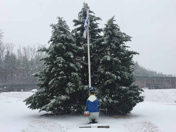
The penguin mascot at FLIR Systems Inc. on Midland Road during the Wednesday morning snow. (Photo courtesy Nick Wyatt)

Filed Under: Front Page News, Top Stories, Weather Tagged With: Anderson County, flood watch, National Weather Service, NWS

Advertisements


Join the club!

If you appreciate our work, please consider subscribing. Besides helping us, your subscription will give you access to our premium content.

Some of our stories are free, brought to you by Oak Ridge Today with help from our members—advertisers, subscribers, and sponsors.

But some are premium content, available only to members. Those are in-depth, investigative, or exclusive stories that are available only on Oak Ridge Today. They generally require significant time to report, write, and publish.

You can subscribe for as little as $5 per month.

You can read more about your options here.

We currently offer five primary subscription options to readers, and they include benefits.

Basic

  • Basic monthly subscription ($5 per month)—access premium content
  • Basic annual subscription ($60 per year)—access premium content

Pro

  • Pro monthly subscription ($10 per month)—access premium content, get breaking news emails first, and submit one press release or public service announcement per month
  • Pro annual subscription ($100 per year)—save $20 per year, access premium content, get breaking news emails first, and submit one press release or public service announcement per month

Temporary

  • Temporary access ($3 per week for two weeks)

We also have advanced subscription options. You can see them here.

We also accept donations. You can donate here.

If you prefer to send a check for a subscription or donation, you may do so by mailing one to:

Oak Ridge Today
P.O. Box 6064
Oak Ridge, TN 37831

Thank you for your consideration and for reading Oak Ridge Today. We appreciate your support.

Commenting Guidelines

We welcome comments, but we ask you to follow a few guidelines:

1) Please use your real name, including last name. Please also use a valid e-mail address.
2) Be civil. Don't insult others, attack their character, or get personal.
3) Stick to the issues.
4) No profanity.
5) Keep your comments to a reasonable length and to a reasonable number per article.

We reserve the right to remove any comments that violate these guidelines. Comments held for review, usually from those posting for the first time, may not post if they violate these guidelines. Thank you for your patience and understanding. Thank you also for reading Oak Ridge Today and for participating in the discussion.

More information is available here.

Comments

  1. johnhuotari says

    February 21, 2015 at 7:50 pm

    I was just out driving. Main roads are good (e.g., Turnpike, Illinois, Tennessee), but even some well-traveled side streets like Pennsylvania and West Outer have some slushy, slick spots, so I’d recommend using caution if you drive.

    Less well-traveled side streets appear to have more snow and slippery spots.

    Reply
    • johnhuotari says

      February 21, 2015 at 10:35 pm

      Note: I drove to Clinton/Norris a little while ago (between about 8:30 and 10 p.m. Saturday), and besides the ice and snow on some roads, which has become pretty slick in areas, there are also some big pools of standing water on some roads, including on Highway 61 between Oak Ridge and I-75. So, please be careful if you drive tonight.

      Parts of some side roads and even small hills had become pretty slippery in Oak Ridge by about 10 p.m. Saturday.

      Reply

Leave a Reply Cancel reply

Your email address will not be published. Required fields are marked *

Recent Posts

  • Officers searching for suspect in fatal shooting
  • Oak Ridge to host movie premiere of ‘Oppenheimer’
  • Oak Ridge Schools to host panel discussion, documentary screening for ‘Oppenheimer’
  • Sam Bush to headline Summer Sessions concert
  • Anderson County government offices closed Monday, Tuesday
  • Oak Ridge Community Band performs on Independence Day
  • Fireworks show, music on July 4
  • Library announces check-out changes
  • USA Cycling Time Trial National Championships on Thursday
  • Oak Ridgers celebrate library renovations

Search Oak Ridge Today

About Us

About Oak Ridge Today
What We Cover

How To

Advertise
Subscribe

Contact Us

Contact Oak Ridge Today

Copyright © 2023 Oak Ridge Today