
A man escaped from a vehicle in flood water on Airport Road on the east side of Oliver Springs on Saturday night, Feb. 10, 2018, authorities said. The vehicle, reported to be a Jeep, was submerged under flood water at one time, but its top was visible early Sunday afternoon. (Photo by John Huotari/Oak Ridge Today)
OLIVER SPRINGS—A man escaped from a vehicle in flood water on Airport Road on the east side of Oliver Springs on Saturday night, authorities said.
The vehicle, reported to be a Jeep, was submerged under flood water at one time, but its top was visible early Sunday afternoon.
The man called 911 at the Oliver Springs Police Department at about 9 p.m. Saturday, and the Oliver Springs Police Department responded. Members of the Oliver Springs Fire Department also responded.
But the man was able to escape on his own through flood water reported to be chest-deep, authorities said.
Rescue squads had initially been called, but their responses were canceled after the man was able to get to dry land.
Airport Road floods regularly during heavy rains, and people sometimes try to drive through it and then get stuck. In April 2017, a driver was reported to have escaped from her car in flood waters on the road, but the black Nissan Altima she was driving remained partially submerged the next day.
There are other Anderson County roads that regularly flood during heavy rains. One of the worst is Irwin Mill Road off Sinking Springs Road east of Clinton and south of State Route 61.
The Oliver Springs Police Department announced Sunday morning that Arrowhead Park and several secondary roads had been closed due to flooding, including Airport Road, Midway Drive, Strutt Street, and Bennett Road. Other roads had debris and standing water, so “please be careful,” the OSPD said.
By early Sunday afternoon, the water appeared to have receded in some areas, such as at Arrowhead Park. Flood waters had also receded in some places in Oak Ridge, such as at the intersection of Jefferson Avenue and Jefferson Circle, which had briefly been closed, and next to the intersection of South Illinois Avenue and Oak Ridge Turnpike.
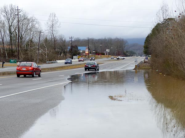
But water remained unusually high in other places, including on Airport Road in Oliver Springs and at East Tri County Boulevard, where creek water had flooded one of the two northbound lanes.
The Oliver Springs Police Department had posted a picture a picture of a car in flood water on Sunday morning, but it wasn’t immediately clear if that vehicle was on Airport Road also and if it was still there Sunday afternoon. Oak Ridge Today did not see a second vehicle on Airport Road early Sunday afternoon.
Authorities urge people to never drive through high water. “Turn around, don’t drown,” they say.
The Tennessee Valley Authority said Melton Hill Dam on the Clinch River was releasing about 150,000 gallons of water per second, using generating turbine and spillways.
“The TVA River Forecast Center and crews at the dams are working to manage this weekend’s heavy rainfall,” TVA said. “Wheeler Dam on the Tennessee River in north Alabama is releasing over one million gallons per second using generating turbines and spillways. We’re storing water in the tributary reservoirs like Norris, Cherokee, Douglas and Fontana to reduce the flood crest on the Tennessee River.”
More rain is possible this week, according to the seven-day forecast for Oak Ridge posted by the National Weather Service in Morristown.
The Weather Service said rivers, streams, and creeks have been in minor to moderate flood stages through Sunday, with water levels expected to keep rising through the evening.
“Please check this site http://ow.ly/CY3Y30ikG1v for more information on water levels and expected crests,” the NWS said.
More information will be added as it becomes available.
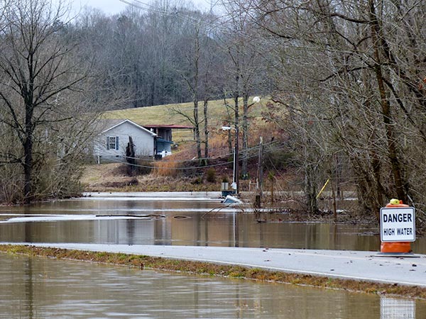
A flooded creek closed Midway Drive in Oliver Springs on Sunday, Feb. 11, 2018. (Photo by John Huotari/Oak Ridge Today)
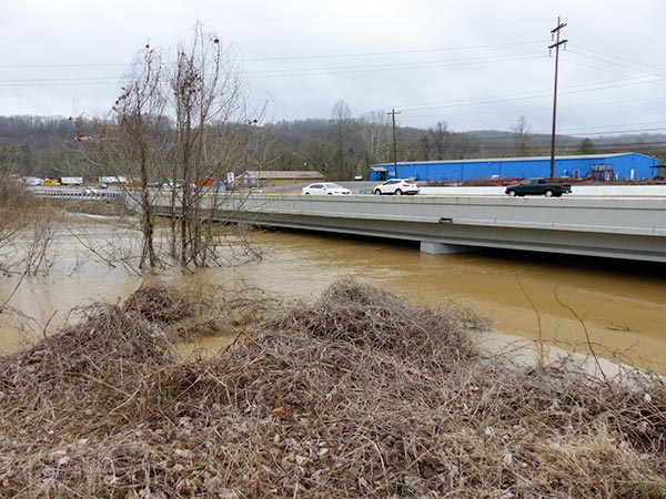
High creek water flows under East Tri County Boulevard in Oliver Springs early Sunday afternoon, Feb. 11, 2018. (Photo by John Huotari/Oak Ridge Today)
High creek water covers one of the two northbound lanes of East Tri County Boulevard in Oliver Springs early Sunday afternoon, Feb. 11, 2018. (Photo by John Huotari/Oak Ridge Today)
A man escaped from a vehicle in flood water on Airport Road on the east side of Oliver Springs on Saturday night, Feb. 10, 2018, authorities said. The vehicle, reported to be a Jeep, was submerged under flood water at one time, but its top was visible early Sunday afternoon. (Photo by John Huotari/Oak Ridge Today)
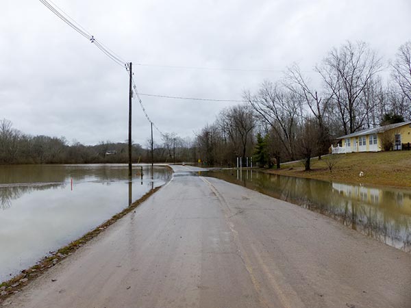
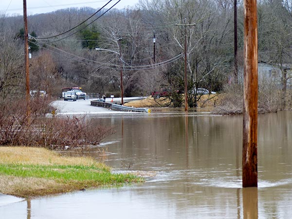
Flooding was unusually high on Airport Road just east of Oliver Springs early Sunday afternoon, Feb. 11, 2018. (Photo by John Huotari/Oak Ridge Today)
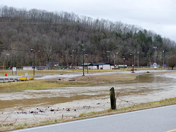
Flood waters appeared to have receded from Arrowhead Park in Oliver Springs early Sunday afternoon, Feb. 11, 2018. (Photo by John Huotari/Oak Ridge Today)
More information will be added as it becomes available.
Do you appreciate this story or our work in general? If so, please consider a monthly subscription to Oak Ridge Today. See our Subscribe page here. Thank you for reading Oak Ridge Today.
Copyright 2018 Oak Ridge Today. All rights reserved. This material may not be published, broadcast, rewritten, or redistributed.


Leave a Reply