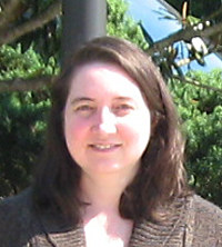
Roane State Community College Geographic Information Systems (GIS) student Chris Zerr said she has “loved maps since I was a little kid.”
“They’re like putting together a puzzle that has lots of pieces. Maps allow you to discover what’s there and what’s not there,” she said.
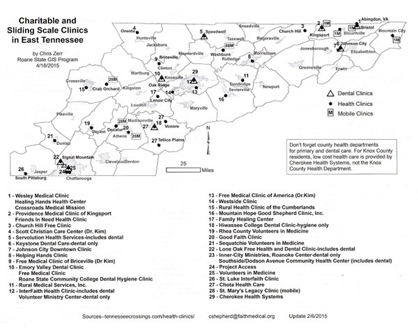
Maps that Zerr recently designed are helping people discover where they can find affordable and often much-needed medical care.
As an honors project for Roane State, Zerr focused on an organization that benefits thousands of people. Remote Area Medical, or RAM as most people know it, was established in 1985 by Stan Brock to provide basic medical care through mobile clinic events in underserved, isolated or impoverished communities.
Services are offered on a free, sliding scale, or charitable basis through participating clinics. A list of clinics in Tennessee exists, but many of the care providers working with RAM are from out of state and have no idea of Tennessee geography.
RAM volunteer Star Lakavage contacted Pat Wurth, Roane State GIS program director, to check if Wurth had a student who might be interested in creating maps for RAM. Wurth contacted Zerr in January and suggested the project. Zerr went to work on the enormous task of mapping all 61 participating clinics in East, Middle, and West Tennessee.
Zerr worked from a list consisting of the name, address, and phone number of participating organizations. Accessing the United States Post Office website, Zerr verified and corrected all of the clinic addresses. Next, she used ArcGIS application to create three different map layouts, each designed with points, lines, and polygons to indicate location, county, and city borders. She also created a legend to differentiate what services are offered at each participating location.
To add more value to the map, Zerr also listed pertinent, detailed information for each clinic on the reverse of each map. This would allow anyone serviced at a RAM clinic to seek follow-up care at a participating health facility according to their individual needs.
“Patients were appreciative of having this resource and many stated never knowing so many options existed,” said Rebecca Barnum, a registered nurse and medical lead for RAM. “This project has benefited both patients and RAM staff in finding a bridge to help those without primary care coverage connect with possible long-term care providers. I am grateful and inspired that a student would invest the time and consideration to complete this project for the betterment of the statewide community and for the future of those it serves.”
Lakavage said the maps are valuable resources.
“Like we always say in GIS, you never see the problem/possibilities until you put it in a map,” Lakavage said.
Zerr earned her bachelor’s degree in 1992 in an unrelated field. She took a few GIS courses at Roane State in 1997 but returned in June 2014 to earn her degree. She will finish the program this fall.
Roane State offers a one-year certificate and a two-year degree in Geographic Information Systems. For more information, visit roanestate.edu/gis or contact Wurth at (865) 354-3000, ext. 2275, or [email protected].
To learn more about Remote Area Medical, call (865) 579-1530 or visit ramusa.org.

Roane State Geographic Information Systems student Chris Zerr created maps for Remote Area Medical. This map shows healthcare services in the East Tennessee region. (Submitted image)


Leave a Reply