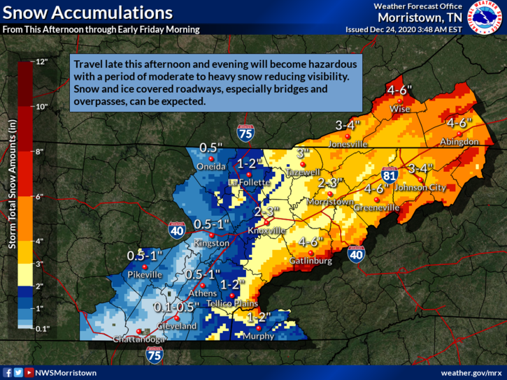
Snow is likely in the Oak Ridge area starting late this afternoon, according to the National Weather Service in Morristown.
The forecast called for rain before 3 p.m. Rain mixed with snow are likely between 3 and 4 p.m., and snow is likely after 4 p.m., the National Weather Service said. A total daytime snow accumulation of less than one inch is possible.
There is a chance of snow before 7 p.m. Christmas Eve, then a chance of snow showers, mainly between 7 p.m. and 3 a.m. Christmas Day, the Weather Service said.
The high today (Thursday, December 24) was forecast at 49. Tonight is expected to be mostly cloudy, with a low around 19. The chance of precipitation tonight is 40 percent.
It was raining in Oak Ridge mid-afternoon Thursday, and the rain was mixed with snow starting at 3 p.m.
A winter weather advisory is in effect through 4 a.m. Christmas Day.
Christmas Day is expected to be partly sunny, with a high near 29, and wind gusts could reach as high as 20 mph.
Friday night is expected to be mostly clear, with a low around 15.
Temperatures could warm to highs near 41 on Saturday and 50 on Sunday.
Leave a Reply