Note: This story was last updated at 4:10 p.m.
The Federal Aviation Administration and U.S. Department of Energy have agreed to restrict drone flights over Oak Ridge National Laboratory, Y-12 National Security Complex, and five other federal sites.
It is the first time the FAA has placed specific airspace restrictions for unmanned aircraft, or “drones,” over DOE sites.
Under the new rules, no drones can be operated within the restricted areas from the ground (surface) up to an altitude of 400 feet. The airspace restrictions take effect Friday, December 29.
Here are the seven sites that are affected:
- Hanford Site in Franklin County, Washington
- Idaho National Laboratory in Idaho Falls, Idaho
- Los Alamos National Laboratory in Los Alamos, New Mexico
- Oak Ridge National Laboratory in Oak Ridge, Tennessee
- Pantex Plant in Amarillo, Texas
- Savannah River National Laboratory in Aiken, South Carolina
- Y-12 National Security Complex in Oak Ridge, Tennessee
The airspace restrictions were announced Monday by the FAA, and they were described in an FAA Notice to Airmen, or NOTAM.
Details about where drone flights are restricted are here.
The FAA has placed similar airspace restrictions over military bases and more recently issued flight restrictions over 10 Department of Interior facilities, including several large dams and iconic landmarks.
The FAA said the restrictions over the seven DOE facilities were requested by U.S. national security and law enforcement agencies. The FAA said it is using its existing authority under a section of federal law called “Special Security Instructions” to address the concerns about unauthorized drone operations over the seven DOE facilities.
The national security restrictions for the DOE sites are pending until they become effective on Friday, December 29. There are only a few exceptions that permit drone flights within these restrictions, and they must be coordinated with the individual facility and/or the FAA, the FAA said.
“To ensure the public is aware of these restricted locations, the FAA has created an interactive map online,” the FAA said. “The link to these restrictions is also included in the FAA’s B4UFLYmobile app. The app will be updated within 60 days to reflect these airspace restrictions. Additional information, including frequently asked questions, is available on the FAA’s UAS website.”
Operators who violate the airspace restrictions may be subject to enforcement action, including potential civil penalties and criminal charges.
The FAA said it is considering additional requests from other federal security agencies for restrictions using the FAA’s authority to support national security and defense.
Drones are also known as unmanned aircraft systems. They are aircraft without a human pilot onboard; instead, they are controlled from an operator on the ground.
“When you fly a drone in the United States, it is your responsibility to understand and abide by the rules,” the FAA said.
ORNL and Y-12, which are protected sites that require permission to enter, both declined to comment on Friday on their security capabilities related to drones.
You can see an interactive map that outlines the boundaries or the pending airspace restrictions for ORNL and Y-12 by visiting this site: http://uas-faa.opendata.arcgis.com/. Here are some instructions to help:
- When the page pops up, read the notice and click on “Agree.”
- On the next page, click on “Map of FAA UAS Data,” which should be in the navigation bar near the top of the site.
- On the next page, look for the “Esri World Geocoder” inquiry box on the upper left on page.
- Type in Oak Ridge National Laboratory or Y-12 National Security Complex. Select them and/or click on them, as necessary with your browser, when they pop up on the list.
- The next page will show you the lab’s location or Y-12’s location in a bright yellow geometric box. The yellow box outlines the pending area or the airspace restrictions that take effect December 29, 2017. You should be able to zoom into or out of the map, possibly using the “+” or “-” buttons. Depending upon your computer and browser, you should also be able to move the map horizontally and vertically as required.
- No drones can be operated within the restricted areas from the ground (surface) up to an altitude of 400 feet.
More information will be added as it becomes available.
See the FAA press release here.
Access map information here.

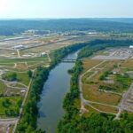
The Y-12 National Security Complex in Oak Ridge is pictured above in June 2012. (Photo courtesy NNSA)
Do you appreciate this story or our work in general? If so, please consider a monthly subscription to Oak Ridge Today. See our Subscribe page here. Thank you for reading Oak Ridge Today.
Copyright 2017 Oak Ridge Today. All rights reserved. This material may not be published, broadcast, rewritten, or redistributed.


Leave a Reply