
Floodwaters rose close to road level at the intersection of Oak Ridge Turnpike and Illinois Avenue after heavy rains fell in Oak Ridge on Saturday afternoon and evening, April 22, 2017. (Photo by John Huotari/Oak Ridge Today)
Oak Ridge emergency workers responded to a car crash that injured two people, two fallen trees, and a possible apartment complex evacuation due to flooding during the severe thunderstorms on Saturday.
Heavy rain from the storms led to widespread flooding in Oak Ridge starting late Saturday afternoon. The water appeared to have receded in places a few hours later, or by early Saturday night.
Emergency workers made preparations Saturday evening to possibly evacuate apartments on Royce Circle, where water covered part of the roadway and rose near the first floor of an apartment complex at the northeast end of the circle. The apartments, which are next to Robertsville Road and just east of Willow Brook Elementary School, are in a low-lying area between two creeks that flow down along Jefferson Avenue and intersect with East Fork Poplar Creek, which was swollen with floodwaters on Saturday.
Authorities had made preparations to see how many people lived on the first floor of the Royce Circle apartment complex in case the residents had to be evacuated, Oak Ridge Fire Department Chief Darryl Kerley said. Of the 10 people there, all but one had another place to go, he said. Authorities were watching the water, Kerley said.
“We think it’s receding,” he said Saturday night.
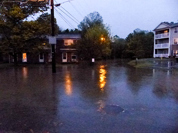
Authorities made preparations to possibly evacuate residents at apartments on Royce Circle after heavy rains led to flooding on Saturday, April 22, 2017, but the floodwaters appeared to be receding Saturday night. (Photo by John Huotari/Oak Ridge Today)
Kerley went back to the apartment buildings just before 10 p.m. Saturday to check on the water level.
“It looks like a considerable amount of water has receded,” Kerley said.
But more rain is possible at midnight, and more thunderstorms are possible on Sunday—a 30 to 40 percent chance on Sunday, the chief said.
During the storms on Saturday, there was a single-vehicle crash near Horizon Center in west Oak Ridge. The vehicle went off the roadway, into the woods, and hit a tree, leaving one person unconscious, Kerley said.
One person had to be extricated and taken to the University of Tennessee Medical Center in Knoxville. A second patient with an arm injury went to Methodist Medical Center of Oak Ridge, Kerley said.
Also Saturday, one tree fell and pulled down power lines and landed on a car, while a second tree fell through a house on Outer Drive. Those residents will have lodging with help from Red Cross, Kerley said.
The Y-12 Fire Department helped with the Outer Drive call, Kerley said, and the Oliver Springs Fire Department was on standby Saturday evening.
Kerley said the Emergency Operations Center, which is at the Oak Ridge Municipal Building, was activated for about 1.5 hours on Saturday.
“This is the worst flooding I’ve seen,” Kerley said. Water got under the asphalt in the Briarcliff neighborhood, and it came up from under the storm drains at Fire Station Number 2 near Home Depot, putting 10 inches of water in the truck bay.
The parking lot at Fire Station Number 3 on Tuskegee Drive had about 18 inches of water in the parking lot, Kerley said.
A basin at the southwest corner of the intersection of Oak Ridge Turnpike and Illinois Avenue filled up, rising close to road level. The basin is at the intersection of East Fork Poplar Creek and a creek that flows through Alvin K. Bissell Park, both of which were much higher than normal.
East Fork Poplar Creek rose to within a few inches of the bottom of the bridge on Oak Ridge Turnpike near the Rocky Top Market at Jefferson Avenue.
Water at the intersection of Jefferson Avenue and North Jefferson Circle was estimated at about 18 inches deep.
The Oak Ridge Police Department, Oak Ridge Electric Department, and Oak Ridge Public Works Department were also out working Saturday night, responding to other car crashes, power outages, and flooding, among other calls.
Late Saturday night, the City of Oak Ridge said on Twitter that crews were still working to restore power after a widespread outage caused by the strong storms.
They’ve managed to get power back to some areas, but many others are still affected, the city said. Crews will keep working throughout the night, the city said.
There were reports of power lines down and flooding in surrounding communities as well, continuing into early Saturday night.
More information will be added as it becomes available.
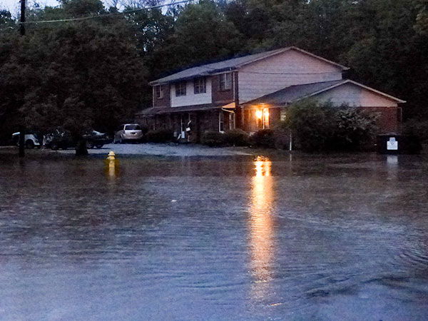
Floodwaters rose near homes on Royce Circle and covered the roadway, which is off Robertsville Road near Willow Brook Elementary School, after heavy rains fell in Oak Ridge on Saturday afternoon and evening, April 22, 2017. (Photo by John Huotari/Oak Ridge Today)
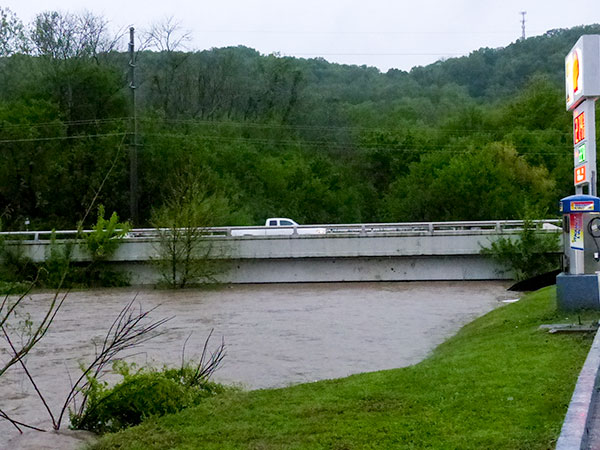
East Fork Poplar Creek rose to within a few inches of the bottom of a bridge on Oak Ridge Turnpike near Rocky Top Market on Jefferson Avenue after heavy rains fell in Oak Ridge on Saturday afternoon and evening, April 22, 2017. (Photo by John Huotari/Oak Ridge Today)
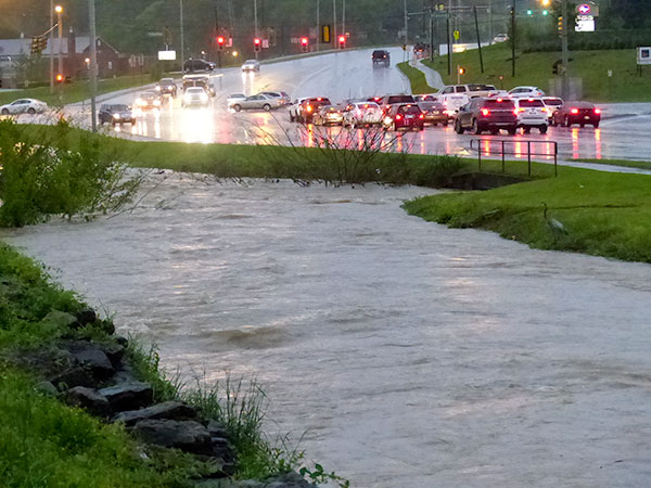
East Fork Poplar Creek intersects with a creek that drains out of Alvin K. Bissell Park in the area near the sidewalk fence after heavy rains fell in Oak Ridge on Saturday afternoon and evening, April 22, 2017. (Photo by John Huotari/Oak Ridge Today)
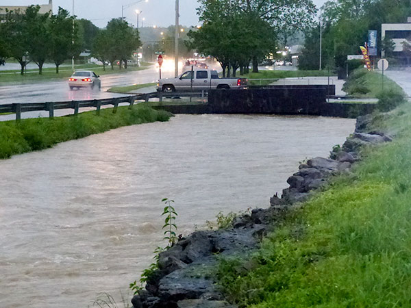
The swollen East Fork Poplar Creek, much higher than normal, rushes along South Illinois Avenue after heavy rains fell in Oak Ridge on Saturday afternoon and evening, April 22, 2017. (Photo by John Huotari/Oak Ridge Today)
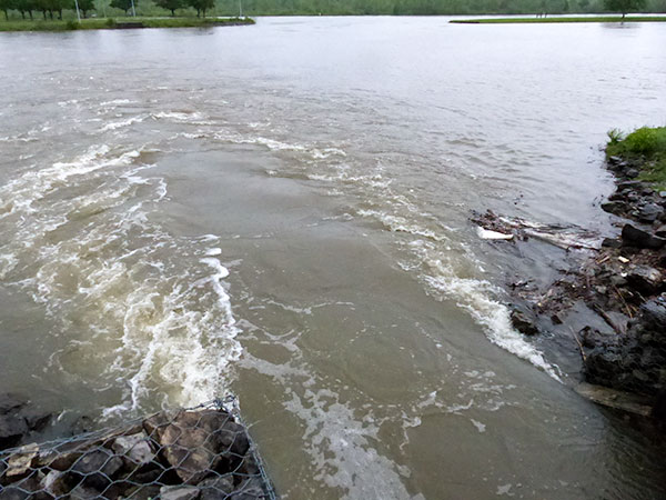
Fast-moving floodwater from east Oak Ridge gushes into the embayment at Oak Ridge Marina after heavy rains in Oak Ridge on Saturday afternoon and evening, April 22, 2017. (Photo by John Huotari/Oak Ridge Today)
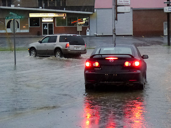
One vehicle, an SUV, drives through floodwaters after heavy rains fell in Oak Ridge on Saturday afternoon and evening, April 22, 2017, but a car backs up to find an alternate route. The floodwaters, at Jefferson Avenue and North Jefferson Circle, were estimated at up to about 18 inches deep. (Photo by John Huotari/Oak Ridge Today)
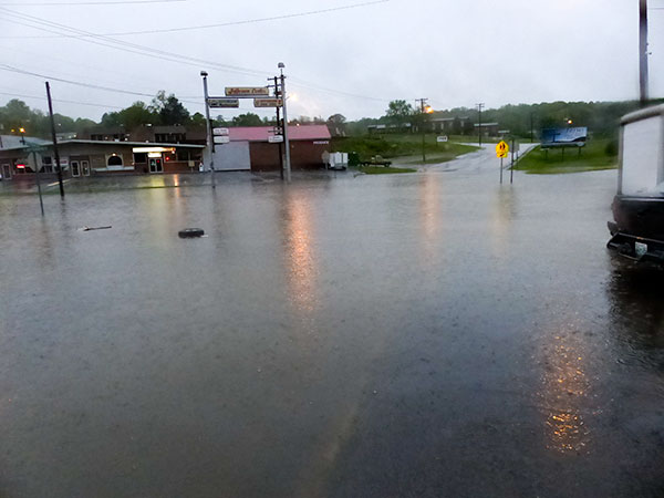
Floodwaters at the intersection of Jefferson Avenue and North Jefferson Circle were estimated at up to about 18 inches deep after heavy rains fell in Oak Ridge on Saturday afternoon and evening, April 22, 2017. (Photo by John Huotari/Oak Ridge Today)
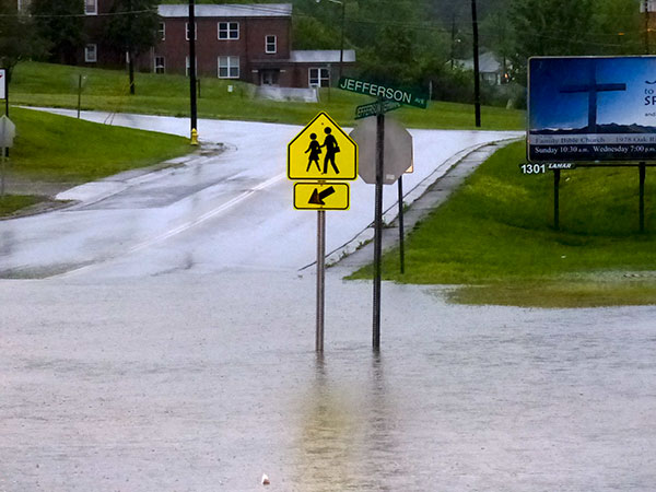
Floodwaters at the intersection of Jefferson Avenue and North Jefferson Circle were estimated at up to about 18 inches deep after heavy rains fell in Oak Ridge on Saturday afternoon and evening, April 22, 2017. (Photo by John Huotari/Oak Ridge Today)
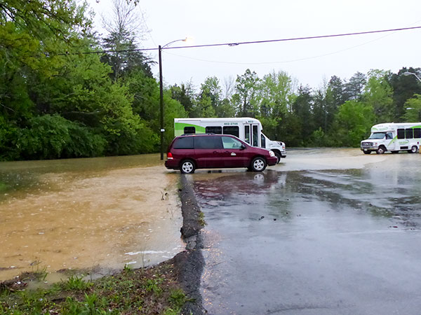
Part of the parking lot flooded at the county-owned building on Emory Valley Road, and a small creek near the building flooded a large area nearby after heavy rains fell in Oak Ridge on Saturday afternoon and evening, April 22, 2017. (Photo by John Huotari/Oak Ridge Today)
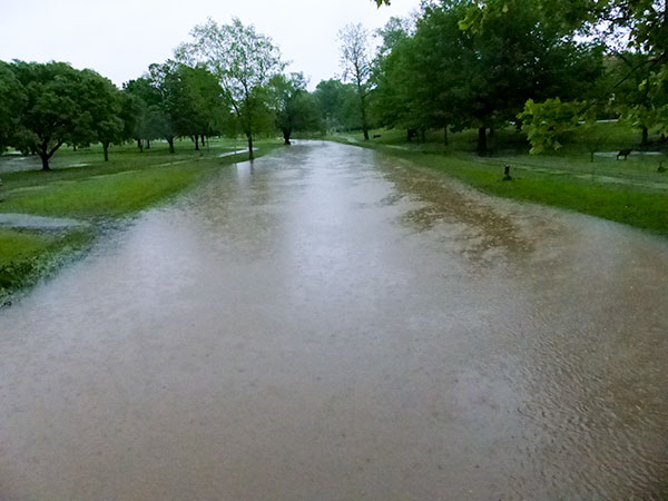
A creek that flows through Alvin K. Bissell Park was several feet higher than normal after heavy rains fell in Oak Ridge on Saturday afternoon and evening, April 22, 2017. (Photo by John Huotari/Oak Ridge Today)
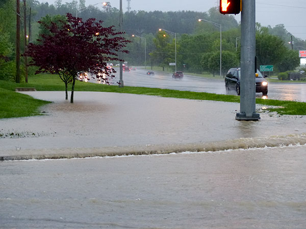
A flooded ditch in front of Panera Bread poured water over a sidewalk on South Illinois Avenue after heavy rains fell in Oak Ridge on Saturday, April 22, 2017. (Photo by John Huotari/Oak Ridge Today)
More information will be added as it becomes available.
Do you appreciate this story or our work in general? If so, please consider a monthly subscription to Oak Ridge Today. See our Subscribe page here. Thank you for reading Oak Ridge Today.
Copyright 2017 Oak Ridge Today. All rights reserved. This material may not be published, broadcast, rewritten, or redistributed.


Philip W Nipper says
Power was out in Hendrix Creek subdivision for about 6 hrs. Thanks to those involved with the restoration!
John, I was wondering how our new equalization basins performed during this rain event? Worked as designed? Might make for a good story. Maybe you could get some info from the city on how they did and if there were any sewage spills / overflows that will have to be reported to the EPA.
johnhuotari says
Thank you, Philip. I wasn’t aware of the power outage in Hendrix Creek. Glad to hear you got your power back.
I also hadn’t thought about the new equalization basins and how well they did during the storm. I think that’s a good question, especially given the investment we’ve made (the city and its ratepayers) in upgrading the sewer system to prevent overflows. I’ll try to find out. I wonder with all that rain if the city would be able to determine if there were any overflows.
I could be wrong, but it looked to me like water was actually bubbling up from a storm water manhole cover that was submerged under water at Royce Circle. That made me wonder if the storm water system was overwhelmed by the heavy rain. I’m not sure if the water there was bubbling up or flowing down since the cover was under water, but it looked more like it was bubbling up.
Ellen Smith says
The sanitary sewer system upgrade (which is not just those equalization basins, but also included capacity increases in some of the sewer mains, as wells measures to reduce inflow) was designed to prevent overflows from major storm events (I don’t remember the specifications for the design storm — it might have been something like a 10-year 24-hour storm), but the system capacity isn’t unlimited (and EPA doesn’t demand that). It’s possible that this weekend’s rainfall has been larger than the design storm. It will be interesting to see how the new system has performed.
It’s very possible that you were seeing water bubbling up from a storm water drain. Storm drains aren’t usually designed to handle extreme rainfall events, and if they get more water than they can handle, they can overflow.
johnhuotari says
Thank you, Ellen.