
Roads in Oak Ridge were mostly clear after snow on Friday night and Saturday morning, Jan. 6 and 7, 2017, but a few snowy spots remained. Pictured above is Orange Lane in north Oak Ridge. (Photo by John Huotari/Oak Ridge Today)
Main roads in Oak Ridge were mostly clear after a snowstorm on Friday night and Saturday morning, but a few snowy spots remained on side streets.
Main streets such as Oak Ridge Turnpike and Illinois Avenue appeared to be completely clear. Heavily traveled secondary roads such as Tennessee Avenue, New York Avenue, Georgia Avenue, Rutgers Avenue, and Outer Drive appeared to be mostly or completely clear. The few snow-covered spots appeared to be mostly on side streets that aren’t as heavily traveled, such as Orange Lane and Orchard Lane in north Oak Ridge.
Much of the snow that fell Friday night and Saturday morning appeared to have melted, including on the hillside next to Blankenship Field that is often used for sledding after snow falls.
The National Weather Service isn’t forecasting any more snow until Tuesday, when there is a slight chance of rain and showers.
But the forecast calls for cold temperatures the next few days, with a low of 8 degrees Fahrenheit Saturday night and 14 on Sunday night.
The heaviest snowfall Friday night and Saturday morning occurred along the Tennessee and North Carolina mountains and foothills, where five to eight inches of snow fell, the National Weather Service said. One to four inches was common elsewhere across the valley.
Forecasters are warning of widespread black ice tonight (Saturday, January 7).
“Temperatures will remain well below freezing overnight, changing any water or slush to ice after sunset,” the Weather Service said.
The black ice is expected to form on untreated roads and could last into Sunday morning.
“Motorists should use extreme caution while driving and allow for additional time to safely reach their destinations,” the National Weather Service said.
See the National Weather Service website here.
See the seven-day forecast for Oak Ridge here.
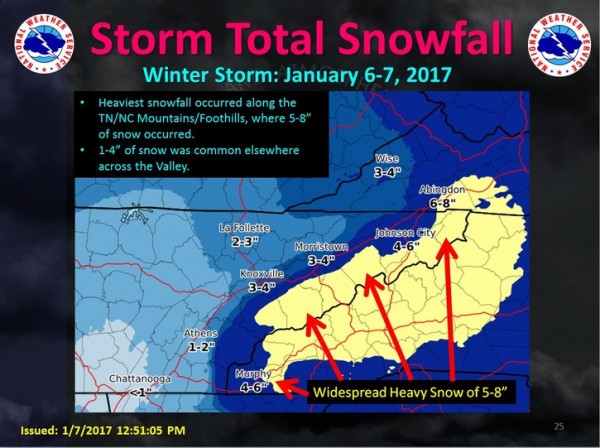
Here’s a look at the latest snowfall totals for the Jan. 6-7, 2017 winter storm. Note how much the snow totals vary from west to east across the area. Locations along the TN/NC mountains saw 5-8″, the central and northern Valley, 2-4″, and the Southern Valley and Plateau 1-2″. In fact, the cutoff was so sharp, eastern portions of Knox County saw 4″, while western areas saw an inch. (Image courtesy National Weather Service in Morristown)
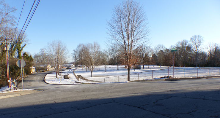
The intersection of Outer Drive and Michigan Avenue was completely clear of snow at Cedar Hill Park on Saturday afternoon, Jan. 7, 2017. (Photo by John Huotari/Oak Ridge Today)
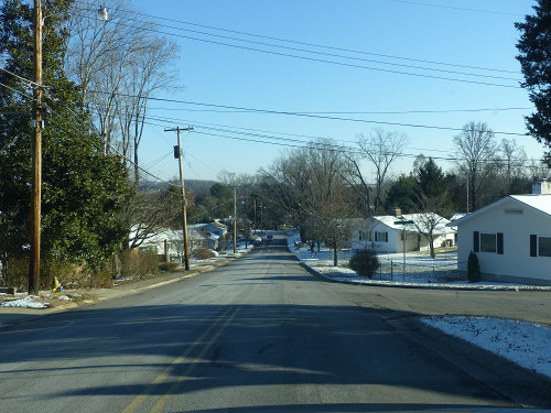
New York Avenue was completely clear of snow on Saturday afternoon, Jan. 7, 2017. (Photo by John Huotari/Oak Ridge Today)
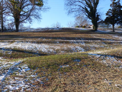
Little snow was left at the hill used for sledding next to Blankenship Field in central Oak Ridge on Saturday afternoon, Jan. 7, 2017. (Photo by John Huotari/Oak Ridge Today)
Leave a Reply